call_end

    • Pl chevron_right

      Marcus Lundblad: Midsommer Maps

      news.movim.eu / PlanetGnome • 18 June • 4 minutes

    As tradition has it, it's about time for the (Northern Hemisphere) summer update on the happenings around Maps!

    about-49.alpha.png
    About dialog for GNOME Maps 49.alpha development


    Bug Fixes

    Since the GNOME 48 release in March, there's been some bug fixes, such as correctly handling daylight savings time in public transit itineraries retrieved from Transitous. Also James Westman fixed a regression where the search result popover wasn't showing on small screen devices (phones) because of sizing issues.

    More Clickable Stuff

    More symbols can now be directly selected in the map view by clicking/tapping on there symbols, like roads and house numbers (and then also, like any other POI can be marked as favorites).
    place-bubble-road.png
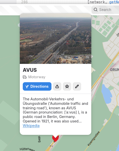
    Showing place information for the AVUS motorway in Berlin

    And related to traffic and driving, exit numbers are now shown for highway junctions (exits) when available.
    motorway-exit-right.png
    Showing information for a highway exit in a driving-on-the-right locallity

    motorway-exit-left.png
    Showing information for a highway exit in a driving-on-the-left locallity

    Note how the direction the arrow is pointing depends on the side of the road vehicle traffic drives in the country/territoy of the place…
    Also the icon for the “Directions” button shows a “turn off left” mirrored icon now for places in drives-on-the-left countries as an additional attention-to-detail.

    Furigana Names in Japanese

    Since some time (around when we re-designed the place information “bubbles”) we show the native name for place under the name translated in the user's locale (when they are different).
    As there exists an established OpenStreetMap tag for phonetic names in Japanese (using Hiragana), name:ja-Hira akin to Furigana ( https://en.wikipedia.org/wiki/Furigana ) used to aid with pronounciation of place names. I had been thinking that it might be a good idea to show this when available as the dimmed supplimental text in the cases where the displayed name and native names are identical, and the Hiragana name is available. E.g. when the user's locale is Japanese and looking at Japanese names.  For other locales in these cases the displayed name would typically be the Romaji name with the Japanese full (Kanji) name displayed under it as the native name.
    So, I took the opportunity to discuss this with my college Daniel Markstedt, who speaks fluent Japanese and has lived many years in Japan. As he like the idea, and demo of it, I decided to go ahead with this!
    hiragana-name.png
    Showing a place in Japanese with supplemental Hiragana name

    Configurable Measurement Systems

    Since like the start of time, Maps has  shown distances in feet and miles when using a United States locale (or more precisely when measurements use such a locale, LC_MEASUREMENT when speaking about the environment variables). For other locales using standard metric measurements.
    Despite this we have several times recieved bug reports about Maps not  using the correct units. The issue here is that many users tend to prefer to have their computers speaking American English.
    So, I finally caved in and added an option to override the system default.
    hamburger-preferences.png
    Hamburger menu

    measurement-system-menu.png
    Hamburger menu showing measurement unit selection

    Station Symbols

    One feature I had been wanted to implement since we moved to vector tiles and integrated the customized highway shields from OpenStreeMap Americana is showing localized symbols for e.g. metro stations. Such as the classic “roundel” symbol used in London, and the ”T“ in Stockholm.
    After adding the network:wikidata tag to the pre-generated vector tiles this has been possible to implement. We choose to rely on the Wikidata tag instead of the network name/abbreviations as this is more stable and names could risk getting collitions with unrelated networks having the same (short-) name.
    hamburg-u-bahn.png
    U-Bahn station in Hamburg

    copenhagen-metro.png
    Metro stations in Copenhagen

    boston-t.png
    Subway stations in Boston

    berlin-s-bahn.png
    S-Bahn station in Berlin

    This requires the stations being tagged consitently to work out. I did some mass tagging of metro stations in Stockholm, Oslo, and Copenhagen. Other than that I mainly choose places where's at least partial coverage already.
    If you'd like to contribute and update a network with the network Wikidata tag, I prepared to quick steps to do such an edit with the JOSM OpenStreetMap desktop editor.
    Download a set of objects to update using an Overpass query, as an example, selecting the stations of Washing DC metro

    [out:xml][timeout:90][bbox:{{bbox}}];

    (

    nwr["network"="Washington Metro"]["railway"="station"];

    );

    (._;>;);

    out meta;

    josm-download-overpass-query.png
    JOSM Overpass download query editor

    Select the region to download from

    josm-select-region.png
    Select region in JOSM

    Select to only show the datalayer (not showing the background map) to make it easier to see the raw data.

    josm-show-layers.png
    Toggle data layers in JOSM

    Select the nodes.

    josm-select-nodes.png
    Show raw datapoints in JSOM

    Edit the field in the tag edit panel to update the value for all selected objects

    josm-edit-network-wikidata-tag.png
    Showing tags for selected objects

    Note that this sample assumed the relevant station node where already tagged with network names (the network tag). Other queries to limit selection might be needed.

    Also it could also be a good idea to reach out to local OSM communities before making bulk edits like this (e.g. if there is no such tagging at all in specific region) to make sure it would be aliged with expectations and such.

    Then it will also potentially take a while before it gets include in out monthly vector tile  update.

    When this has been done, given a suitable icon is available as e.g. public domain or commons in WikimediaCommons, it could be bundled in data/icons/stations and a definition added in the data mapping in src/mapStyle/stations.js.

    And More…

    One feature that has been long-wanted is the ability to dowload maps for offline usage. Lately precisely this is something James Westman has been working on.

    It's still an early draft, so we'll see when it is ready, but it already look pretty promising.

    hamburger-preferences.png
    Showing the new Preferences option


    download-dialog.png
    Preference dialog with dowloads

    download-select-area.png
    Selecting region to download

    download-rename.png
    Entering a name for a downloaded region

    download-areas.png
    Dialog showing dowloaded areas

    And that's it for now!